Airports at the highest altitudes, located in the mountains or on the highlands. A high altitude which rhymes with the drop in atmospheric pressure which increases the taxiing distance to allow planes to take off and therefore requires a longer runway than at lower altitudes. in Bahamas.
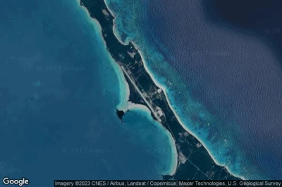
#1 Little Darby Island airport at Little Darby Island (Bahamas) MYXF
Altitude : 16 m = 52ft
Little Darby Island airport is located close to Little Darby Island, South Eleuthera at 105 km↑, Rock Sound at 116 km↑, Kemps Point at 117 km↑, Long Island at 134 km↑, Rum Cay at 140 km↑, Congo Town at 142 km↑,
-> Aviation weather for Little Darby Island airport
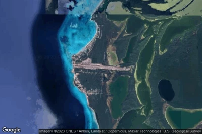
#2 Governor's Harbour airport at Governor's Harbour (Bahamas) MYEM GHB
Altitude : 8 m = 26ft
Governor's Harbour airport is located close to Governor's Harbour, Upper Bogue at 38 km↑, North Eleuthera District at 40 km↑, Dunmore Town at 40 km↑, Kemps Point at 45 km↑, Rock Sound at 45 km↑, South Eleuthera at 56 km↑,
The longest runway measure : 2446 m = 8025ft
- runway 15/33 : 2446m = 8025ft
-> Aviation weather for Governor's Harbour airport
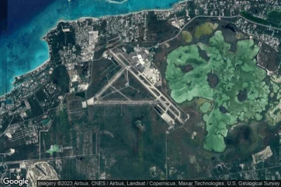
#3 Lee Stocking airport at Lee Stocking (Bahamas) MYEL
Altitude : 7 m = 23ft
Lee Stocking airport is located close to Lee Stocking, South Eleuthera at 114 km↑, Long Island at 119 km↑, Rock Sound at 125 km↑, Kemps Point at 126 km↑, Rum Cay at 127 km↑, Port Nelson at 130 km↑,
-> Aviation weather for Lee Stocking airport
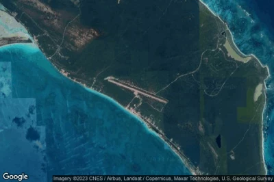
#4 San Salvador airport at San Salvador (Bahamas) MYSM ZSA
Altitude : 7 m = 23ft
San Salvador airport is located close to San Salvador, Victoria Hill at 1.9 km↑, Cockburn Town at 3.4 km↑, San Salvador District at 4.3 km↑, Rum Cay at 55 km↑, Port Nelson at 57 km↑, Long Island at 112 km↑,
The longest runway measure : 2438 m = 7999ft
- runway 10/28 : 2438m = 7999ft
-> Aviation weather for San Salvador airport
#5 Clarence Bain airport at Mangrove Cay (Bahamas) MYAB MAY
Altitude : 6 m = 20ft
Clarence Bain airport is located close to Mangrove Cay, Congo Town at 17 km↑, South Andros at 41 km↑, Minns at 47 km↑, Andros Town at 47 km↑, North Andros District at 68 km↑, Macbride at 89 km↑,
The longest runway measure : 1524 m = 5000ft
- runway 09/27 : 1524m = 5000ft
-> Aviation weather for Clarence Bain airport
#6 Moores Island airport at Moore's Island (Bahamas) MYA0
Altitude : 5 m = 16ft
Moores Island airport is located close to Moore's Island, Hard Bargain at 0.5 km↑, Moore’s Island District at 2 km↑, Sandy Point at 37 km↑, Marsh Harbour District at 40 km↑, South Abaco District at 44 km↑, North Abaco District at 54 km↑,
-> Aviation weather for Moores Island airport
#7 Congo Town airport at Andros (Bahamas) MYAK COX
Altitude : 5 m = 16ft
Congo Town airport is located close to Andros, Congo Town at 1.1 km↑, South Andros at 27 km↑, Minns at 63 km↑, Andros Town at 63 km↑, North Andros District at 85 km↑, Commonwealth of The Bahamas at 101 km↑,
The longest runway measure : 1615 m = 5299ft
- runway 10/28 : 1615m = 5299ft
-> Aviation weather for Congo Town airport
#8 Lynden Pindling International airport at Nassau (Bahamas) MYNN NAS
Altitude : 5 m = 16ft
Lynden Pindling International airport is located close to Nassau, Macbride at 3.1 km↑, Commonwealth of The Bahamas at 9.6 km↑, Nassau at 13 km↑, New Providence District at 18 km↑, Minns at 48 km↑, Andros Town at 48 km↑,
The longest runway measure : 3460 m = 11352ft
- runway 14/32 : 3460m = 11352ft
- runway 09/27 : 2522m = 8274ft
-> Aviation weather for Lynden Pindling International airport
#9 Rum Cay airport at (Bahamas) MYRP RCY
Altitude : 5 m = 16ft
Rum Cay airport is located close to Rum Cay at 2.2 km↑, Port Nelson at 5.7 km↑, Cockburn Town at 51 km↑, San Salvador District at 52 km↑, Victoria Hill at 54 km↑, Long Island at 59 km↑,
The longest runway measure : 1372 m = 4501ft
- runway 09/27 : 1372m = 4501ft
-> Aviation weather for Rum Cay airport
#10 Arthur's Town airport at Arthur's Town (Bahamas) MYCA ATC
Altitude : 5 m = 16ft
Arthur's Town airport is located close to Arthur's Town, South Eleuthera at 55 km↑, Kemps Point at 60 km↑, Rock Sound at 61 km↑, Rum Cay at 134 km↑, Upper Bogue at 135 km↑, Dunmore Town at 138 km↑,
The longest runway measure : 2138 m = 7014ft
- runway 12/30 : 2138m = 7014ft
- runway 14/32 : 2134m = 7001ft
-> Aviation weather for Arthur's Town airport
#11 Big Whale Cay airport at Big Whale Cay (Bahamas) MYX4
#12 Great Harbour Cay airport at Bullocks Harbour (Bahamas) MYBG GHC
#13 Port Nelson Airstrip airport at Port Nelson (Bahamas) BS-0002
#14 North Eleuthera airport at North Eleuthera (Bahamas) MYEH ELH
#15 Cat Cay airport at North Cat Cay (Bahamas) MYCC CXY
#16 Abaco I Walker C airport at (Bahamas) MYAW WKR
#17 Hog Cay airport at Hog Cay (Bahamas) MYEY
#18 Deadman's Cay airport at Deadman's Cay (Bahamas) MYLD LGI
#19 Rock Sound airport at Rock Sound (Bahamas) MYER RSD
#20 Hard Bargain airport at (Bahamas) MYLR
#21 Farmers Cay Airstrip airport at Little Farmers Cay (Bahamas) BS-0005
#22 Exuma International airport at George Town (Bahamas) MYEF GGT
#23 Black Point Airstrip airport at Black Point (Bahamas) MYEB
#24 Stella Maris airport at Stella Maris (Bahamas) MYLS SML
#25 Mayaguana airport at Abrahams Bay (Bahamas) MYMM MYG
#26 Spring Point airport at Spring Point (Bahamas) MYAP AXP
#27 Rudder Cut Cay airport at Rudder Cut Cay (Bahamas) MYX7
#28 South Bimini airport at South Bimini (Bahamas) MYBS BIM
#29 Spanish Cay airport at (Bahamas) MYAX
#30 Hog Key airport at Long Island (Bahamas) MYXC
#31 Duncan Town airport at (Bahamas) MYRD DCT
#32 Darby Island airport at Darby Island (Bahamas) MYX8
#33 Sampson Cay airport at Sampson Cay (Bahamas) MYXH
#34 Little Whale Cay Berry Islands airport at Little Whale Cay (Bahamas) MYZ3
#35 Inagua airport at Matthew Town (Bahamas) MYIG IGA
#36 West End airport at West End (Bahamas) MYGW WTD
#37 New Bight airport at Cat Island (Bahamas) MYCB TBI
#38 Cape Santa Maria Airstrip airport at Galliot Cay (Bahamas) BS-0003
#39 Cave Cay Airstrip airport at Cave Cay (Bahamas) BS-0004
#40 Andros Town airport at (Bahamas) MYAF ASD
#41 Leonard M Thompson International airport at Marsh Harbour (Bahamas) MYAM MHH
#42 San Andros airport at Andros Island (Bahamas) MYAN SAQ
#43 Sandy Point airport at (Bahamas) MYAS
#44 Treasure Cay airport at Treasure Cay (Bahamas) MYAT TCB
#45 Chub Cay airport at (Bahamas) MYBC CCZ
#46 Auxiliary airport at Grand Bahama (Bahamas) MYGM GBI
#47 Colonel Hill airport at Colonel Hill (Bahamas) MYCI CRI
#48 Pitts Town airport at Pitts Town (Bahamas) MYCP PWN
#49 Normans Cay airport at (Bahamas) MYEN NMC
#50 Staniel Cay airport at (Bahamas) MYES TYM
#51 Grand Bahama International airport at Freeport (Bahamas) MYGF FPO
#52 Hawks Nest Creek airport at Hawks Nest Creek (Bahamas) MYCH
#53 Cay Sal airport at Cay Sal (Bahamas) MYCS
#54 Deep Water Cay airport at Deep Water Cay (Bahamas) MYGD
#55 Leaf Cay airport at Leaf Cay (Bahamas) MYXD
Data sources
- AVWX (avwx.rest)
- Aerial maps : Google Maps (www.google.com), Microsoft Bing (www.microsoft.com) ou OpenStreetMap (www.openstreetmap.org)


