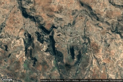
Los aeropuertos que tienen las pistas más largas, porque están en una altitud donde los aviones necesitan más velocidad para poder volar. Y pistas largas para acomodar aviones más grandes o aviones no estándar en Lesoto.
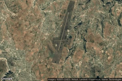
#1 aeropuerto Maseru Moshoeshoe a Maseru (Lesoto) FXMM MSU
Altitud : 1630 m = 5348ft
aeropuerto Maseru Moshoeshoe se encuentra cerca de Maseru, Machekoaneng a 3.1 km↑, Maseru a 18 km↑, Ladybrand a 31 km↑, Mafeteng District a 38 km↑, Teyateyaneng a 40 km↑, Marseilles a 40 km↑,
La medida de la pista más larga : 3200 m = 10499ft
- pista 04/22 : 3200m = 10499ft
- pista 11/29 : 1010m = 3314ft
-> tiempo de aviación para el aeropuerto del Maseru Moshoeshoe
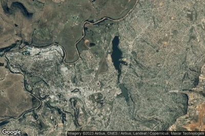
#2 aeropuerto Maseru Mejametalana a Maseru (Lesoto) FXMU
Altitud : 1556 m = 5105ft
aeropuerto Maseru Mejametalana se encuentra cerca de Maseru, Maseru a 2.4 km↑, Ladybrand a 13 km↑, Machekoaneng a 15 km↑, Marseilles a 25 km↑, Teyateyaneng a 30 km↑, Clocolan a 44 km↑,
La medida de la pista más larga : 1381 m = 4531ft
- pista 04/22 : 1381m = 4531ft
- pista 11/29 : 470m = 1542ft
-> tiempo de aviación para el aeropuerto del Maseru Mejametalana
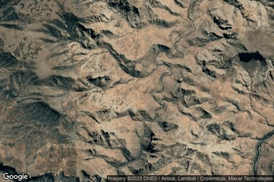
#3 aeropuerto Sehlabathebe a Sehlabathebe (Lesoto) FXSE
Altitud : 2225 m = 7300ft
aeropuerto Sehlabathebe se encuentra cerca de Sehlabathebe, Qacha’s Nek a 29 km↑, Qachas Nek a 40 km↑, Underberg a 46 km↑, Himeville a 50 km↑, Thaba-Tseka a 60 km↑, Mokhotlong a 70 km↑,
-> tiempo de aviación para el aeropuerto del Sehlabathebe
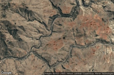
#4 aeropuerto Matabeng Village a Matabeng Village (Lesoto) FXMV
Altitud : 1875 m = 6152ft
aeropuerto Matabeng Village se encuentra cerca de Matabeng Village, Qacha’s Nek a 21 km↑, Qachas Nek a 35 km↑, Thaba-Tseka a 38 km↑, Mokhotlong a 64 km↑, Kingdom of Lesotho a 64 km↑, Underberg a 66 km↑,
-> tiempo de aviación para el aeropuerto del Matabeng Village
#5 aeropuerto Nohanas a Nohanas (Lesoto) FXNH
Altitud : 1646 m = 5400ft
aeropuerto Nohanas se encuentra cerca de Nohanas, Mohale’s Hoek District a 22 km↑, Tosing a 32 km↑, Mohales Hoek a 39 km↑, Quthing a 40 km↑, Quthing a 41 km↑, Mafeteng District a 46 km↑,
-> tiempo de aviación para el aeropuerto del Nohanas
#6 aeropuerto Nkaus a Nkaus (Lesoto) FXNK NKU
Altitud : 1713 m = 5620ft
aeropuerto Nkaus se encuentra cerca de Nkaus, Tosing a 46 km↑, Quthing a 48 km↑, Qachas Nek a 49 km↑, Qacha’s Nek a 53 km↑, Mohale’s Hoek District a 53 km↑, Kingdom of Lesotho a 58 km↑,
-> tiempo de aviación para el aeropuerto del Nkaus
#7 aeropuerto Pelaneng a Pelaneng (Lesoto) FXPG PEL
Altitud : 2195 m = 7201ft
aeropuerto Pelaneng se encuentra cerca de Pelaneng, Leribe District a 26 km↑, Butha-Buthe a 32 km↑, Thaba-Tseka a 46 km↑, Butha-Buthe a 47 km↑, Kingdom of Lesotho a 49 km↑, Leribe a 53 km↑,
-> tiempo de aviación para el aeropuerto del Pelaneng
#8 aeropuerto Quthing a Quthing (Lesoto) FXQG UTG
Altitud : 1631 m = 5351ft
aeropuerto Quthing se encuentra cerca de Quthing, Quthing a 1.1 km↑, Tosing a 21 km↑, Mohale’s Hoek District a 27 km↑, Quthing a 29 km↑, Mohales Hoek a 35 km↑, Lady Grey a 57 km↑,
-> tiempo de aviación para el aeropuerto del Quthing
#9 aeropuerto Qacha's Nek a Qacha's Nek (Lesoto) FXQN UNE
Altitud : 1859 m = 6099ft
aeropuerto Qacha's Nek se encuentra cerca de Qacha's Nek, Qachas Nek a 1.7 km↑, Qacha’s Nek a 15 km↑, Thaba-Tseka a 66 km↑, Quthing a 73 km↑, Tosing a 79 km↑, Kingdom of Lesotho a 79 km↑,
-> tiempo de aviación para el aeropuerto del Qacha's Nek
#10 aeropuerto Matabeng Store a Matabeng Store (Lesoto) FXMT
Altitud : 1920 m = 6299ft
aeropuerto Matabeng Store se encuentra cerca de Matabeng Store, Qacha’s Nek a 24 km↑, Thaba-Tseka a 33 km↑, Qachas Nek a 38 km↑, Kingdom of Lesotho a 59 km↑, Mokhotlong a 62 km↑, Underberg a 70 km↑,
-> tiempo de aviación para el aeropuerto del Matabeng Store
#11 aeropuerto Sehonghong a Sehonghong (Lesoto) FXSH SHK
#12 aeropuerto Sekakes a Sekakes (Lesoto) FXSK SKQ
#13 aeropuerto Semonkong a Semonkong (Lesoto) FXSM SOK
#14 aeropuerto Seshutes a Seshutes (Lesoto) FXSS SHZ
#15 aeropuerto St. Theresa a St. Theresa (Lesoto) FXST
#16 aeropuerto Thaba Tseka a Thaba-Tseka (Lesoto) FXTA THB
#17 aeropuerto Tebellong a Tebellong (Lesoto) FXTB
#18 aeropuerto Tlokoeng a Tlokoeng (Lesoto) FXTK TKO
#19 aeropuerto Bobete a Bobete (Lesoto) FXBB
#20 aeropuerto Mashai Store a Mashai Store (Lesoto) FXMS
#21 aeropuerto Mohlanapeng a Mohlanapeng (Lesoto) FXMP
#22 aeropuerto Mantsonyane a Mantsonyane (Lesoto) FXMN
#23 aeropuerto Malefiloane a Malefiloane (Lesoto) FXML
#24 aeropuerto Mokhotlong a Mokhotlong (Lesoto) FXMK MKH
#25 aeropuerto Mohale's Hoek a Mohale's Hoek (Lesoto) FXMH
#26 aeropuerto Mafeteng a Mafeteng (Lesoto) FXMF MFC
#27 aeropuerto Matsaile a Matsaile (Lesoto) FXMA
#28 aeropuerto Letseng a Letseng (Lesoto) FXLT
#29 aeropuerto Lesobeng a Lesobeng (Lesoto) FXLS LES
#30 aeropuerto Leribe a Leribe (Lesoto) FXLR LRB
#31 aeropuerto Lebakeng a Lebakeng (Lesoto) FXLK LEF
#32 aeropuerto Kolberg a Kolberg (Lesoto) FXKB
#33 aeropuerto Katse a Katse (Lesoto) FXKA
Fuentes de datos
- AVWX (avwx.rest)
- Vista aérea : Google Maps (www.google.com), Microsoft Bing (www.microsoft.com) ou OpenStreetMap (www.openstreetmap.org)
