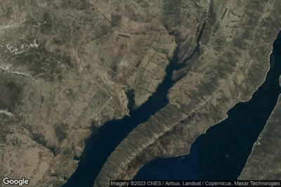
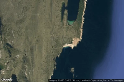
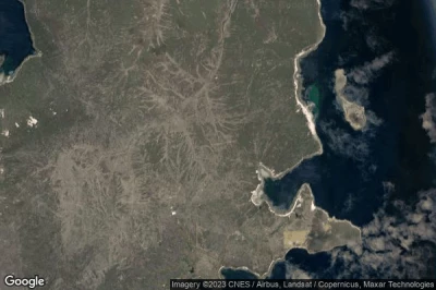
The airports that have the longest runways, because they are at altitude where planes need more speed to be able to fly. And long runways to accommodate larger aircraft or non-standard aircraft in Falkland Islands.
#1 Mount Pleasant airport at Mount Pleasant (Falkland Islands) EGYP MPN
Altitude : 74 m = 243ft
Mount Pleasant airport is located close to Mount Pleasant, Mare Harbour Rancho at 9.2 km↑, Rincon Grande Settlement at 41 km↑, Stanley at 43 km↑, Falkland Islands at 50 km↑, Kaiken at 656 km↑, Río Grande at 659 km↑,
The longest runway measure : 2590 m = 8497ft
- runway 10/28 : 2590m = 8497ft
- runway 05/23 : 1525m = 5003ft
-> Aviation weather for Mount Pleasant airport
#2 Port Stanley airport at Stanley (Falkland Islands) SFAL PSY
Altitude : 23 m = 75ft
Port Stanley airport is located close to Stanley, Stanley at 5.2 km↑, Rincon Grande Settlement at 44 km↑, Mare Harbour Rancho at 49 km↑, Falkland Islands at 96 km↑, Kaiken at 703 km↑, Río Grande at 708 km↑,
The longest runway measure : 918 m = 3012ft
- runway 09/27 : 918m = 3012ft
- runway 18/36 : 338m = 1109ft
-> Aviation weather for Port Stanley airport
#3 Pebble Island Beach Airstrip airport at Pebble Island (Falkland Islands) FK-0036
Pebble Island Beach Airstrip airport is located close to Pebble Island, Falkland Islands at 56 km↑, Rincon Grande Settlement at 89 km↑, Mare Harbour Rancho at 104 km↑, Stanley at 126 km↑, Puerto Deseado at 604 km↑, Río Grande at 615 km↑,
-> Aviation weather for Pebble Island Beach Airstrip airport
#4 Fox Bay East Airstrip airport at Fox Bay East (Falkland Islands) FK-0035
Altitude : 27 m = 89ft
Fox Bay East Airstrip airport is located close to Fox Bay East, Falkland Islands at 66 km↑, Mare Harbour Rancho at 114 km↑, Rincon Grande Settlement at 133 km↑, Stanley at 155 km↑, Río Grande at 552 km↑, Kaiken at 554 km↑,
-> Aviation weather for Fox Bay East Airstrip airport
#5 Sea Lion Island Airstrip airport at Sea Lion Island (Falkland Islands) FK-0034
Altitude : 20 m = 66ft
Sea Lion Island Airstrip airport is located close to Sea Lion Island, Falkland Islands at 77 km↑, Mare Harbour Rancho at 78 km↑, Stanley at 120 km↑, Rincon Grande Settlement at 123 km↑, Kaiken at 582 km↑, Río Grande at 592 km↑,
-> Aviation weather for Sea Lion Island Airstrip airport
#6 Port Howard Airstrip airport at Port Howard (Falkland Islands) FK-0033
Altitude : 19 m = 62ft
Port Howard Airstrip airport is located close to Port Howard, Falkland Islands at 29 km↑, Mare Harbour Rancho at 83 km↑, Rincon Grande Settlement at 85 km↑, Stanley at 115 km↑, Río Grande at 602 km↑, Kaiken at 607 km↑,
-> Aviation weather for Port Howard Airstrip airport
#7 Port Edgar airport at Port Edgar (Falkland Islands) FK-0032
Altitude : 20 m = 66ft
Port Edgar airport is located close to Port Edgar, Falkland Islands at 85 km↑, Mare Harbour Rancho at 131 km↑, Rincon Grande Settlement at 153 km↑, Stanley at 172 km↑, Río Grande at 532 km↑, Kaiken at 533 km↑,
-> Aviation weather for Port Edgar airport
#8 Beaver Island airport at Beaver Island (Falkland Islands) FK-0029
Altitude : 7 m = 23ft
Beaver Island airport is located close to Beaver Island, Falkland Islands at 142 km↑, Mare Harbour Rancho at 195 km↑, Rincon Grande Settlement at 206 km↑, Stanley at 233 km↑, Río Grande at 486 km↑, Kaiken at 497 km↑,
-> Aviation weather for Beaver Island airport
#9 Weddell Island airport at Weddell Island (Falkland Islands) FK-0028
Altitude : 21 m = 69ft
Weddell Island airport is located close to Weddell Island, Falkland Islands at 120 km↑, Mare Harbour Rancho at 172 km↑, Rincon Grande Settlement at 185 km↑, Stanley at 211 km↑, Río Grande at 504 km↑, Kaiken at 513 km↑,
-> Aviation weather for Weddell Island airport
#10 Bleaker Island airport at Bleaker Island (Falkland Islands) FK-0027
Altitude : 4 m = 13ft
Bleaker Island airport is located close to Bleaker Island, Mare Harbour Rancho at 44 km↑, Falkland Islands at 52 km↑, Stanley at 87 km↑, Rincon Grande Settlement at 89 km↑, Kaiken at 612 km↑, Río Grande at 618 km↑,
-> Aviation weather for Bleaker Island airport
#11 Speedwell Island airport at Speedwell Island (Falkland Islands) FK-0026
#12 Douglas Station airport at Douglas (Falkland Islands) FK-0024
#13 George Island airport at George Island House (Falkland Islands) FK-0023
#14 Lively Island airport at Lively (Falkland Islands) FK-0022
#15 Salvador airport at Salvador (Falkland Islands) FK-0020
#16 North Arm airport at North Arm (Falkland Islands) FK-0019
#17 New Island airport at New Island (Falkland Islands) FK-0018
#18 Chartres airport at Chartres (Falkland Islands) FK-0017
#19 Hill Cove airport at Hill Cove (Falkland Islands) FK-0016
#20 Shallow Harbour airport at Shallow Harbour (Falkland Islands) FK-0015
#21 Dunnose Head airport at Dunnose Head (Falkland Islands) FK-0014
#22 Port Abermarle airport at Port Abermarle (Falkland Islands) FK-0013
#23 Port Stephens airport at Port Stephens (Falkland Islands) FK-0012
#24 Carcass Island Landing Strip airport at Carcass Island (Falkland Islands) FK-0011
#25 Saunders Island Landing Strip airport at Saunders Island Settlement (Falkland Islands) FK-0010
#26 Port Howard Purvis Pond Airstrip airport at Port Howard Settlement (Falkland Islands) FK-0009
#27 Port San Carlos Landing Strip airport at Port San Carlos (Falkland Islands) FK-0008
#28 Spring Point Landing Strip airport at Spring Point Settlement (Falkland Islands) FK-0007
#29 Roy Cove Landing Strip airport at Roy Cove (Falkland Islands) FK-0006
#30 Goose Green airport at Goose Green (Falkland Islands) FK-0005
#31 West Point Island Landing Strip airport at West Point Island (Falkland Islands) FK-0004
#32 Sea Lion Lodge Airstrip airport at Sea Lion Island (Falkland Islands) FK-0003
#33 Pebble Island Landing Strip airport at Pebble Island Settlement (Falkland Islands) FK-0002
#34 Fox Bay Clay Airstrip airport at Fox Bay (Falkland Islands) FK-0001
Data sources
- AVWX (avwx.rest)
- Aerial maps : Google Maps (www.google.com), Microsoft Bing (www.microsoft.com) ou OpenStreetMap (www.openstreetmap.org)


