Airports at the highest altitudes, located in the mountains or on the highlands. A high altitude which rhymes with the drop in atmospheric pressure which increases the taxiing distance to allow planes to take off and therefore requires a longer runway than at lower altitudes. in Cyprus.
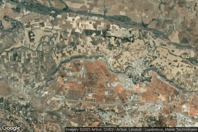
#1 Marki airport at (Cyprus) CY-0007
Altitude : 344 m = 1129ft
Marki airport is located close to Pera at 5.9 km↑, Xeri at 6.6 km↑, Psimolofou at 6.8 km↑, Ergates at 7.3 km↑, Lythrodhondas at 7.5 km↑, Kato Dheftera at 8.4 km↑,
-> Aviation weather for Marki airport
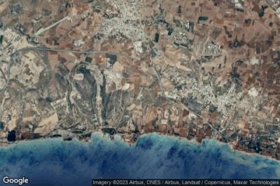
#2 Kornos Highway Strip airport at (Cyprus) CY-0005
Altitude : 340 m = 1115ft
Kornos Highway Strip airport is located close to Kornos at 1.6 km↑, Mosphiloti at 5 km↑, Psevdhas at 7 km↑, Alambra at 9.1 km↑, Kophinou at 9.5 km↑, Lymbia at 11 km↑,
-> Aviation weather for Kornos Highway Strip airport
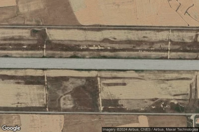
#3 Lakatamia airport at (Cyprus) CY-0001
Altitude : 231 m = 758ft
Lakatamia airport is located close to Xeri at 3.5 km↑, Kato Dheftera at 4.4 km↑, Páno Defterá at 6.3 km↑, Psimolofou at 7.2 km↑, Nicosia at 7.9 km↑, Athalassa at 8.4 km↑,
-> Aviation weather for Lakatamia airport
#4 Pınarbaşı Air Base airport at Ağırdağ (Cyprus) CY-0003
Altitude : 231 m = 758ft
Pınarbaşı Air Base airport is located close to Ağırdağ, Eparchía Kerýneias at 2.9 km↑, Kyrenia at 8.6 km↑, Yerolakkos at 10 km↑, Lapithos at 11 km↑, Mammari at 14 km↑, Kokkini Trimithia at 15 km↑,
-> Aviation weather for Pınarbaşı Air Base airport
#5 Cyprus Gliding Club airport at (Cyprus) CY-0081
Altitude : 228 m = 748ft
Cyprus Gliding Club airport is located close to Mammari at 1.8 km↑, Kokkini Trimithia at 2.8 km↑, Yerolakkos at 6 km↑, Akaki at 6.9 km↑, Meniko at 8.5 km↑, Eparchía Kerýneias at 11 km↑,
-> Aviation weather for Cyprus Gliding Club airport
#6 Kophinou Highway Strip airport at (Cyprus) CY-0006
Altitude : 136 m = 446ft
Kophinou Highway Strip airport is located close to Kophinou at 3.8 km↑, Kornos at 9.4 km↑, Tersephanou at 11 km↑, Mosphiloti at 12 km↑, Psevdhas at 13 km↑, Meneou at 13 km↑,
-> Aviation weather for Kophinou Highway Strip airport
#7 Ercan International airport at Nicosia (Cyprus) LCEN ECN
Altitude : 123 m = 404ft
Ercan International airport is located close to Nicosia, Tymbou at 2.8 km↑, Athalassa at 8.8 km↑, Yeri at 9.4 km↑, Pallouriotissa at 10 km↑, Athienou at 11 km↑, Nicosia at 12 km↑,
The longest runway measure : 2755 m = 9039ft
- runway 11/29 : 2755m = 9039ft
- runway 16/34 : 276m = 906ft
-> Aviation weather for Ercan International airport
#8 Kingsfield Air Base airport at Dhekelia Sovereign Base Area (Cyprus) CY-0004
Altitude : 88 m = 289ft
Kingsfield Air Base airport is located close to Dhekelia Sovereign Base Area, Xylotymbou at 2.3 km↑, Pyla at 2.8 km↑, Pergamos at 3.1 km↑, Voroklini at 6.3 km↑, Athna at 7.8 km↑, Troulli at 9.3 km↑,
-> Aviation weather for Kingsfield Air Base airport
#9 RAF Dhekelia airport at Dhekelia Sovereign Base Area (Cyprus) CY-0041
Altitude : 48 m = 157ft
RAF Dhekelia airport is located close to Dhekelia Sovereign Base Area, Xylotymbou at 2.9 km↑, Pergamos at 6.4 km↑, Pyla at 6.5 km↑, Athna at 7.8 km↑, Voroklini at 8.4 km↑, Avgorou at 9.6 km↑,
-> Aviation weather for RAF Dhekelia airport
#10 Lefkoniko / Geçitkale Air Base airport at Lefkoniko (Geçitkale) (Cyprus) GEC CY-0002
Altitude : 45 m = 148ft
Lefkoniko / Geçitkale Air Base airport is located close to Lefkoniko (Geçitkale), Lefkoniko at 2.8 km↑, Trikomo at 17 km↑, Eparchía Ammochóstou at 17 km↑, Akhyritou at 20 km↑, Athna at 21 km↑, Pergamos at 22 km↑,
-> Aviation weather for Lefkoniko / Geçitkale Air Base airport
#11 Paphos International airport at Paphos (Cyprus) LCPH PFO
#12 Larnaca International airport at Larnarca (Cyprus) LCLK LCA
Data sources
- AVWX (avwx.rest)
- Aerial maps : Google Maps (www.google.com), Microsoft Bing (www.microsoft.com) ou OpenStreetMap (www.openstreetmap.org)


