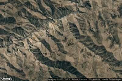
Airports at the highest altitudes, located in the mountains or on the highlands. A high altitude which rhymes with the drop in atmospheric pressure which increases the taxiing distance to allow planes to take off and therefore requires a longer runway than at lower altitudes. in Lesotho.
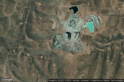
#1 Letseng airport at Letseng (Lesotho) FXLT
Altitude : 3170 m = 10400ft
Letseng airport is located close to Letseng, Mokhotlong at 37 km↑, Butha-Buthe at 40 km↑, Phuthaditjhaba at 54 km↑, Bergville at 57 km↑, Leribe District at 59 km↑, Thaba-Tseka at 62 km↑,
-> Aviation weather for Letseng airport
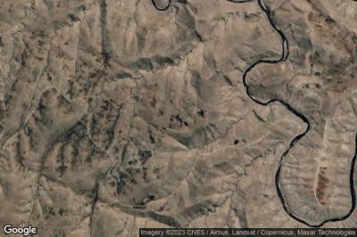
#2 Malefiloane airport at Malefiloane (Lesotho) FXML
Altitude : 2520 m = 8268ft
Malefiloane airport is located close to Malefiloane, Mokhotlong at 13 km↑, Himeville at 56 km↑, Underberg at 59 km↑, Thaba-Tseka at 60 km↑, Bergville at 69 km↑, Estcourt at 75 km↑,
-> Aviation weather for Malefiloane airport
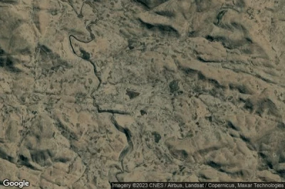
#3 Thaba Tseka airport at Thaba-Tseka (Lesotho) FXTA THB
Altitude : 2286 m = 7500ft
Thaba Tseka airport is located close to Thaba-Tseka, Thaba-Tseka at 0.7 km↑, Kingdom of Lesotho at 35 km↑, Mokhotlong at 51 km↑, Qacha’s Nek at 55 km↑, Maseru at 60 km↑, Leribe District at 65 km↑,
-> Aviation weather for Thaba Tseka airport
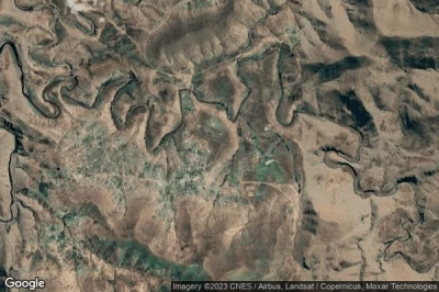
#4 Sehlabathebe airport at Sehlabathebe (Lesotho) FXSE
Altitude : 2225 m = 7300ft
Sehlabathebe airport is located close to Sehlabathebe, Qacha’s Nek at 29 km↑, Qachas Nek at 40 km↑, Underberg at 46 km↑, Himeville at 50 km↑, Thaba-Tseka at 60 km↑, Mokhotlong at 70 km↑,
-> Aviation weather for Sehlabathebe airport
#5 Mashai Store airport at Mashai Store (Lesotho) FXMS
Altitude : 2225 m = 7300ft
Mashai Store airport is located close to Mashai Store, Thaba-Tseka at 26 km↑, Qacha’s Nek at 36 km↑, Qachas Nek at 49 km↑, Mokhotlong at 51 km↑, Kingdom of Lesotho at 57 km↑, Underberg at 68 km↑,
-> Aviation weather for Mashai Store airport
#6 Mohlanapeng airport at Mohlanapeng (Lesotho) FXMP
Altitude : 2223 m = 7293ft
Mohlanapeng airport is located close to Mohlanapeng, Thaba-Tseka at 9.9 km↑, Kingdom of Lesotho at 43 km↑, Qacha’s Nek at 47 km↑, Mokhotlong at 50 km↑, Qachas Nek at 59 km↑, Maseru at 67 km↑,
-> Aviation weather for Mohlanapeng airport
#7 Semonkong airport at Semonkong (Lesotho) FXSM SOK
Altitude : 2195 m = 7201ft
Semonkong airport is located close to Semonkong, Maseru at 38 km↑, Kingdom of Lesotho at 42 km↑, Mohale’s Hoek District at 53 km↑, Mafeteng District at 54 km↑, Tosing at 59 km↑, Thaba-Tseka at 64 km↑,
-> Aviation weather for Semonkong airport
#8 Pelaneng airport at Pelaneng (Lesotho) FXPG PEL
Altitude : 2195 m = 7201ft
Pelaneng airport is located close to Pelaneng, Leribe District at 26 km↑, Butha-Buthe at 32 km↑, Thaba-Tseka at 46 km↑, Butha-Buthe at 47 km↑, Kingdom of Lesotho at 49 km↑, Leribe at 53 km↑,
-> Aviation weather for Pelaneng airport
#9 Mokhotlong airport at Mokhotlong (Lesotho) FXMK MKH
Altitude : 2195 m = 7201ft
Mokhotlong airport is located close to Mokhotlong, Mokhotlong at 1 km↑, Thaba-Tseka at 52 km↑, Bergville at 67 km↑, Himeville at 67 km↑, Underberg at 69 km↑, Butha-Buthe at 75 km↑,
-> Aviation weather for Mokhotlong airport
#10 Lesobeng airport at Lesobeng (Lesotho) FXLS LES
Altitude : 2173 m = 7129ft
Lesobeng airport is located close to Lesobeng, Kingdom of Lesotho at 32 km↑, Thaba-Tseka at 40 km↑, Maseru at 44 km↑, Qacha’s Nek at 48 km↑, Qachas Nek at 52 km↑, Tosing at 75 km↑,
-> Aviation weather for Lesobeng airport
#11 Bobete airport at Bobete (Lesotho) FXBB
#12 Mantsonyane airport at Mantsonyane (Lesotho) FXMN
#13 Katse airport at Katse (Lesotho) FXKA
#14 Tlokoeng airport at Tlokoeng (Lesotho) FXTK TKO
#15 Seshutes airport at Seshutes (Lesotho) FXSS SHZ
#16 Kolberg airport at Kolberg (Lesotho) FXKB
#17 St. Theresa airport at St. Theresa (Lesotho) FXST
#18 Sehonghong airport at Sehonghong (Lesotho) FXSH SHK
#19 Matabeng Store airport at Matabeng Store (Lesotho) FXMT
#20 Matsaile airport at Matsaile (Lesotho) FXMA
#21 Matabeng Village airport at Matabeng Village (Lesotho) FXMV
#22 Qacha's Nek airport at Qacha's Nek (Lesotho) FXQN UNE
#23 Lebakeng airport at Lebakeng (Lesotho) FXLK LEF
#24 Sekakes airport at Sekakes (Lesotho) FXSK SKQ
#25 Nkaus airport at Nkaus (Lesotho) FXNK NKU
#26 Tebellong airport at Tebellong (Lesotho) FXTB
#27 Nohanas airport at Nohanas (Lesotho) FXNH
#28 Quthing airport at Quthing (Lesotho) FXQG UTG
#29 Mafeteng airport at Mafeteng (Lesotho) FXMF MFC
#30 Leribe airport at Leribe (Lesotho) FXLR LRB
#31 Maseru Moshoeshoe airport at Maseru (Lesotho) FXMM MSU
#32 Mohale's Hoek airport at Mohale's Hoek (Lesotho) FXMH
#33 Maseru Mejametalana airport at Maseru (Lesotho) FXMU
Data sources
- AVWX (avwx.rest)
- Aerial maps : Google Maps (www.google.com), Microsoft Bing (www.microsoft.com) ou OpenStreetMap (www.openstreetmap.org)
