Les aéroports aux altitudes les plus élevées, situés en montagne ou sur des hauts plateaux. Une altitude élevée qui rime avec la baisse de la pression atmosphérique qui augmente la distance de roulage pour permettre aux avions de décoller et nécéssite donc une piste plus longue qu'a des altitudes plus modestes. en Bélize.
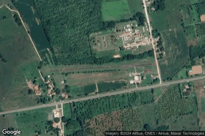
#1 aéroport de Privassion Airstrip à (Bélize) BZ-0007
Altitude : 457 m = 1499ft
aéroport de Privassion Airstrip est situé à proximité de Privassion Camp à 0.8 km↑, San Ignacio à 18 km↑, Spanish Lookout à 20 km↑, Benque Viejo del Carmen à 20 km↑, Melchor de Mencos à 21 km↑, Cayo District à 23 km↑,
-> Météo aéronautique de l'Aéroport Privassion Airstrip
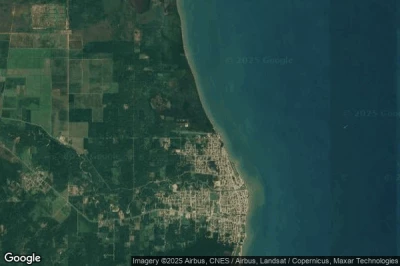
#2 aéroport de Dangriga à Dangriga (Bélize) MZPB DGA BZ-DGA
Altitude : 155 m = 509ft
aéroport de Dangriga est situé à proximité de Dangriga, Dangriga à 1.5 km↑, Hopkins à 14 km↑, Middlesex à 29 km↑, Belize District à 31 km↑, Stann Creek District à 33 km↑, Belize City à 58 km↑,
-> Météo aéronautique de l'Aéroport Dangriga
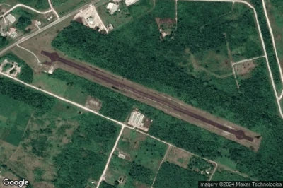
#3 aéroport de Chan Chich Airstrip à Gallon Jug (Bélize) BZ-0001
Altitude : 123 m = 404ft
aéroport de Chan Chich Airstrip est situé à proximité de Gallon Jug, Valley of Peace à 34 km↑, Orange Walk District à 37 km↑, Spanish Lookout à 39 km↑, San Ignacio à 46 km↑, Belmopan à 46 km↑, Belize à 47 km↑,
-> Météo aéronautique de l'Aéroport Chan Chich Airstrip
#4 aéroport de Town Airstrip à San Ignacio (Bélize) MZMF CYD
Altitude : 107 m = 351ft
aéroport de Town Airstrip est situé à proximité de San Ignacio, Benque Viejo del Carmen à 5.2 km↑, Melchor de Mencos à 6.5 km↑, San Ignacio à 6.5 km↑, Spanish Lookout à 18 km↑, Privassion Camp à 18 km↑, Cayo District à 36 km↑,
La plus longue piste mesure : 651 m = 2136ft
- piste unknown/unknown : 651m = 2136ft
-> Météo aéronautique de l'Aéroport Town Airstrip
#5 aéroport de Manatee à (Bélize) MZSL MZE
Altitude : 105 m = 344ft
aéroport de Manatee est situé à proximité de Spanish Lookout à 8.1 km↑, San Ignacio à 15 km↑, Valley of Peace à 21 km↑, Benque Viejo del Carmen à 26 km↑, Melchor de Mencos à 27 km↑, Belmopan à 27 km↑,
-> Météo aéronautique de l'Aéroport Manatee
#6 aéroport de Tres Leguas à Shipyard (Bélize) BZ-0014
Altitude : 86 m = 282ft
aéroport de Tres Leguas est situé à proximité de Shipyard, Orange Walk District à 18 km↑, Orange Walk à 49 km↑, Nicolas Bravo à 61 km↑, Valley of Peace à 65 km↑, Caledonia à 65 km↑, Chicago à 74 km↑,
-> Météo aéronautique de l'Aéroport Tres Leguas
#7 aéroport de Silver Creek à Silver Creek (Bélize) MZKT SVK BZ-SVK
Altitude : 66 m = 217ft
aéroport de Silver Creek est situé à proximité de Silver Creek, Hopkins à 18 km↑, Stann Creek District à 18 km↑, Dangriga à 31 km↑, Middlesex à 35 km↑, Cayo District à 59 km↑, Toledo District à 60 km↑,
-> Météo aéronautique de l'Aéroport Silver Creek
#8 aéroport de Matthew Spain à Spanish Lookout (Bélize) SQS BZ-SQS
Altitude : 61 m = 200ft
aéroport de Matthew Spain est situé à proximité de Spanish Lookout, Spanish Lookout à 4.4 km↑, San Ignacio à 7.3 km↑, Privassion Camp à 18 km↑, Benque Viejo del Carmen à 18 km↑, Melchor de Mencos à 20 km↑, Valley of Peace à 25 km↑,
-> Météo aéronautique de l'Aéroport Matthew Spain
#9 aéroport de Hector Silva Airstrip à Belmopan (Bélize) BCV BZ-BCV
Altitude : 46 m = 151ft
aéroport de Hector Silva Airstrip est situé à proximité de Belmopan, Belmopan à 2.4 km↑, Belize à 3.6 km↑, Valley of Peace à 9.5 km↑, Spanish Lookout à 23 km↑, Privassion Camp à 32 km↑, San Ignacio à 34 km↑,
-> Météo aéronautique de l'Aéroport Hector Silva Airstrip
#10 aéroport d'Orange Walk à Orange Walk (Bélize) MZTH ORZ BZ-ORZ
Altitude : 34 m = 112ft
aéroport d'Orange Walk est situé à proximité de Orange Walk, Orange Walk à 4.4 km↑, Caledonia à 23 km↑, Corozal District à 35 km↑, Orange Walk District à 35 km↑, Ranchito à 41 km↑, Chicago à 41 km↑,
-> Météo aéronautique de l'Aéroport Orange Walk
#11 aéroport de Melinda à Melinda (Bélize) MZML MDB BZ-MDB
#12 aéroport de San Felipe Airstrip à San Felipe (Bélize) BZ-0003
#13 aéroport de Backlanding à Backlanding (Bélize) BZ-0015
#14 aéroport de Corozal Municipal à Corozal (Bélize) CZH BZ-CZH
#15 aéroport de Johnny Chan Chen Airstrip à Chan Chen (Bélize) MZJC
#16 aéroport de Big Creek à Big Creek (Bélize) BGK BZ-BGK
#17 aéroport de Philip S. W. Goldson International à Belize City (Bélize) MZBZ BZE
#18 aéroport d'Independence à Independence (Bélize) INB BZ-INB
#19 aéroport de Santa Cruz à Santa Cruz (Bélize) STU BZ-STU
#20 aéroport de Lighthouse Reef Airstrip à Northern Caye (Bélize) BZ-0002
#21 aéroport de Punta Gorda à Punta Gorda (Bélize) MZPG PND BZ-PND
#22 aéroport de Sir Barry Bowen Municipal à Belize City (Bélize) TZA BZ-TZA
#23 aéroport de Placencia à Placencia (Bélize) MZPL PLJ BZ-PLJ
#24 aéroport de Sartaneja à Sartaneja (Bélize) MZSJ SJX BZ-SJX
#25 aéroport de Caye Chapel à Caye Chapel (Bélize) CYC BZ-CYC
#26 aéroport de John Greif II à San Pedro (Bélize) MZSP SPR BZ-SPR
#27 aéroport de Caye Caulker à Caye Caulker (Bélize) CUK BZ-CUK
Sources des données
- AVWX (avwx.rest)
- Vues aériennes : Google Maps (www.google.com), Microsoft Bing (www.microsoft.com) ou OpenStreetMap (www.openstreetmap.org)


