Airport information, from map to hotels via aeronautical information. And the aeronautical weather for the pilots with current weather and short-term forecasts with METAR (METeorological Aerodrome Report, observation message of meteorological conditions for aviation) and TAF (Terminal Aerodrome Forecast: short-term forecast message of meteorological conditions for aviation ). And other resources such as VAC (Visual Approach Chart) to prepare flights.
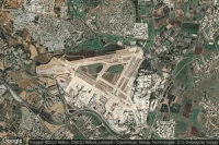
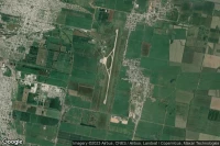
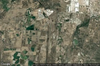
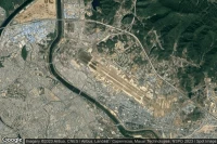
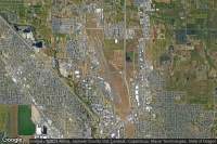
Guadalajara (Mexico)
Don Miguel Hidalgo Y Costilla International airport aviation weather and facilities (MMGL GDL )
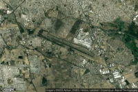
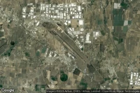
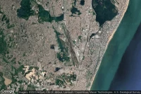
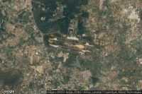
São Paulo (Brazil)
Guarulhos - Governador André Franco Montoro International airport aviation weather and facilities (SBGR GRU )

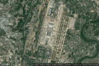
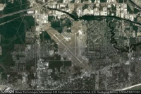
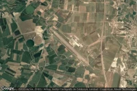
St Augustine (United State)

Northeast Florida Regional airport aviation weather and facilities (KSGJ UST )
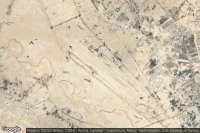
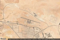
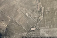
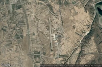
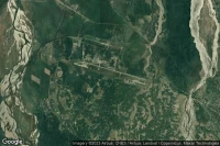
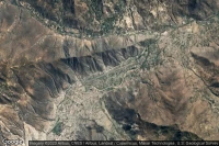
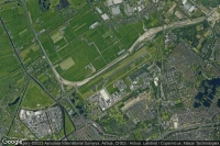
Tamanrasset (Algeria)
Tamanrasset - Aguenar - Hadj Bey Akhamok airport aviation weather and facilities (DAAT TMR )

Varadero (Cuba)

Juan Gualberto Gomez International airport aviation weather and facilities (MUVR VRA )

San Miguel de Tucumán (Argentina)
Teniente Benjamin Matienzo airport aviation weather and facilities (SANT TUC )
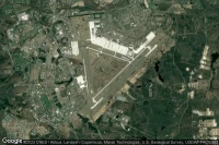
Shijiazhuang (China)
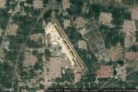
Shijiazhuang Daguocun International airport aviation weather and facilities (ZBSJ SJW )
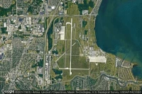
Point Mugu (United State)
Point Mugu Naval Air Station (Naval Base Ventura Co) airport aviation weather and facilities (KNTD NTD )
Plaine Magnein (Mauritius)
Sir Seewoosagur Ramgoolam International airport aviation weather and facilities (FIMP MRU )
Puerto Iguazu (Argentina)

Cataratas Del Iguazú International airport aviation weather and facilities (SARI IGR )
Amritsar (India)
Sri Guru Ram Dass Jee International airport aviation weather and facilities (VIAR ATQ )


Puerto Vallarta (Mexico)
Licenciado Gustavo Díaz Ordaz International airport aviation weather and facilities (MMPR PVR )
Franceville (Gabon)
M'Vengue El Hadj Omar Bongo Ondimba International airport aviation weather and facilities (FOON MVB )
Wrightstown (United State)
Mc Guire Air Force Base airport aviation weather and facilities (KWRI WRI )
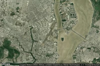
Recife (Brazil)
Guararapes - Gilberto Freyre International airport aviation weather and facilities (SBRF REC )

Salta (Argentina)

Martin Miguel De Guemes International airport aviation weather and facilities (SASA SLA )


Aguascalientes (Mexico)
Lic. Jesús Terán Peredo International airport aviation weather and facilities (MMAS AGU )
Barcelona (Venezuela)

General José Antonio Anzoategui International airport aviation weather and facilities (SVBC BLA )

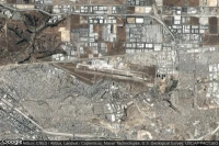
Denpasar (Indonesia)

I Gusti Ngurah Rai International airport aviation weather and facilities (WADD DPS )
Tijuana (Mexico)
General Abelardo L. Rodriguez International airport aviation weather and facilities (MMTJ TIJ )
San Salvador de Jujuy (Argentina)
Gobernador Horacio Guzman International airport aviation weather and facilities (SASJ JUJ )
Monastir (Tunisia)

Monastir Habib Bourguiba International airport aviation weather and facilities (DTMB MIR )
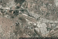
Durango (Mexico)

General Guadalupe Victoria International airport aviation weather and facilities (MMDO DGO )
Saltillo (Mexico)
Plan De Guadalupe International airport aviation weather and facilities (MMIO SLW )
Falmouth (United State)
Cape Cod Coast Guard Air Station airport aviation weather and facilities (KFMH FMH )
Gunnison (United State)

Gunnison Crested Butte Regional airport aviation weather and facilities (KGUC GUC )


Guilin City (China)
Guilin Liangjiang International airport aviation weather and facilities (ZGKL KWL )

Guayaquil (Ecuador)
José Joaquín de Olmedo International airport aviation weather and facilities (SEGU GYE )


Gulfport (United State)
Gulfport Biloxi International airport aviation weather and facilities (KGPT GPT )
Guwahati (India)

Lokpriya Gopinath Bordoloi International airport aviation weather and facilities (VEGT GAU )
Mount Clemens (United State)
Selfridge Air National Guard Base airport aviation weather and facilities (KMTC MTC )

Medford (United State)
Rogue Valley International Medford airport aviation weather and facilities (KMFR MFR )


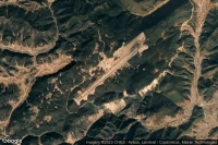
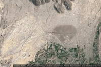
Bangui (Central African Republic)

Bangui M'Poko International airport aviation weather and facilities (FEFF BGF )

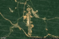
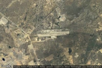
Tarapoto (Peru)

Cadete FAP Guillermo Del Castillo Paredes airport aviation weather and facilities (SPST TPP )
Seguin (United State)

Randolph Air Force Base Auxiliary airport aviation weather and facilities (KSEQ )

Tuxtla Gutiérrez (Mexico)

Angel Albino Corzo International airport aviation weather and facilities (MMTG TGZ )

Piura (Peru)

Capitán FAP Guillermo Concha Iberico International airport aviation weather and facilities (SPUR PIU )
Huánuco (Peru)
Alferez Fap David Figueroa Fernandini airport aviation weather and facilities (SPNC HUU )


Managua (Nicaragua)
Augusto C. Sandino (Managua) International airport aviation weather and facilities (MNMG MGA )
Comayagua (Honduras)

Coronel Enrique Soto Cano Air Base airport aviation weather and facilities (MHSC XPL )
Guantanamo Bay Naval Station (Cuba)

Leeward Point Field airport aviation weather and facilities (MUGM NBW )


San Andrés (Colombia)
Gustavo Rojas Pinilla International airport aviation weather and facilities (SKSP ADZ )
Guaymas (Mexico)
General José María Yáñez International airport aviation weather and facilities (MMGM GYM )


Data sources
- Infos générales : AVWX, France FFPLUM
- METAR : AVWX
- TAF : AVWX
- Météo générale : Openweathermap et AVWX
- NOTAM : FAA
- VAC : France DGAC/SIA, Espagne ENAIRE, Belgique SKEYES
- Aerial maps : Google Maps, Microsoft Bing ou OpenStreetMap