Airport information, from map to hotels via aeronautical information. And the aeronautical weather for the pilots with current weather and short-term forecasts with METAR (METeorological Aerodrome Report, observation message of meteorological conditions for aviation) and TAF (Terminal Aerodrome Forecast: short-term forecast message of meteorological conditions for aviation ). And other resources such as VAC (Visual Approach Chart) to prepare flights.


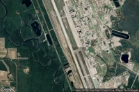
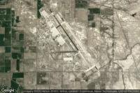
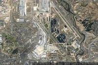
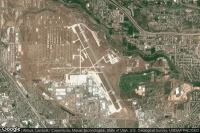
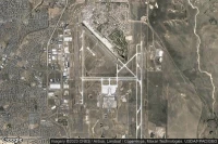
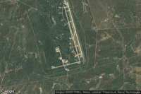
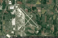
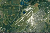
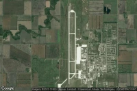
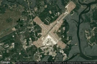
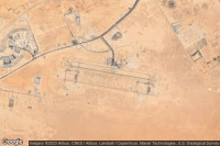
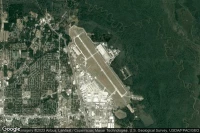
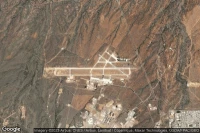
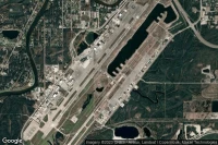
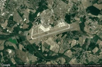
Victorville (United State)
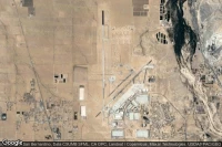
Southern California Logistics airport aviation weather and facilities (KVCV VCV )
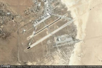

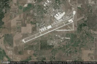
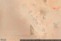
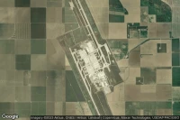
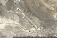
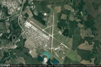
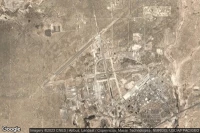
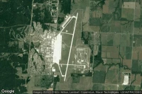
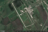
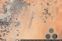
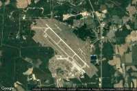
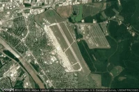
Titusville (United State)
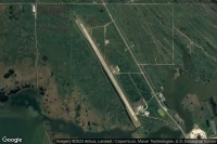
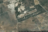
Nasa Shuttle Landing Facility airport aviation weather and facilities (KTTS )
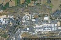
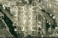
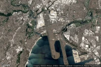
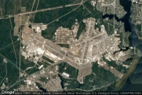
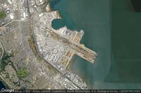
New York (United State)
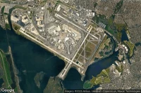
John F Kennedy International airport aviation weather and facilities (KJFK JFK JFK)
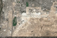
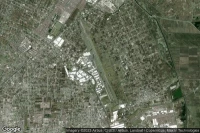
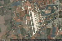
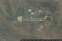
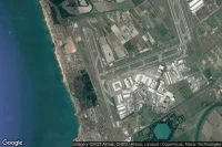
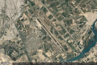
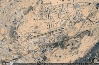
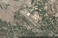
Isfahan (Iran)
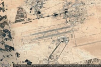
Esfahan Shahid Beheshti International airport aviation weather and facilities (OIFM IFN )
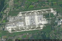
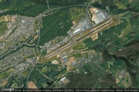
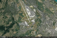
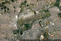
Paris Roissy-en-France (France)
Paris Charles de Gaulle International airport aviation weather and facilities (LFPG CDG )
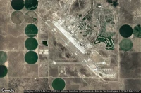
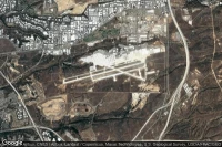
Albuquerque (United State)
Albuquerque International Sunport airport aviation weather and facilities (KABQ ABQ )
Toluca (Mexico)
Licenciado Adolfo Lopez Mateos International airport aviation weather and facilities (MMTO TLC )
Tucson (United State)
Davis Monthan Air Force Base airport aviation weather and facilities (KDMA DMA )
Fort Bliss El Paso (United State)

Biggs Army Air Field (Fort Bliss) airport aviation weather and facilities (KBIF BIF )
Lemoore (United State)
Lemoore Naval Air Station (Reeves Field) airport aviation weather and facilities (KNLC NLC )
Mountain Home (United State)
Mountain Home Air Force Base airport aviation weather and facilities (KMUO MUO )
Colorado Springs (United State)
City of Colorado Springs Municipal airport aviation weather and facilities (KCOS COS )
Rapid City (United State)

Ellsworth Air Force Base airport aviation weather and facilities (KRCA RCA )

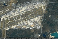
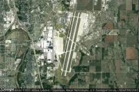
Dallas Fort Worth (United State)
Dallas Fort Worth International airport aviation weather and facilities (KDFW DFW )

Louis Trichardt Southwest (South Africa)
Makhado Air Force Base airport aviation weather and facilities (FALM )
Dugway Proving Ground (United State)
Michael AAF (Dugway Proving Ground) airport aviation weather and facilities (KDPG DPG )
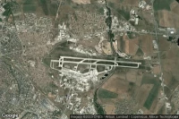
Athens (Greece)
Eleftherios Venizelos International airport aviation weather and facilities (LGAV ATH )
Luxembourg (Luxembourg)
Luxembourg-Findel International airport aviation weather and facilities (ELLX LUX )
Wichita Falls (United State)
Sheppard Air Force Base-Wichita Falls Municipal airport aviation weather and facilities (KSPS SPS )
Hoedspruit (South Africa)
Hoedspruit Air Force Base airport aviation weather and facilities (FAHS HDS )
Sydney (Australia)
Sydney Kingsford Smith International airport aviation weather and facilities (YSSY SYD )

Topeka (United State)
Topeka Regional - Forbes Field airport aviation weather and facilities (KFOE FOE )
Alamogordo (United State)
Holloman Air Force Base airport aviation weather and facilities (KHMN HMN )
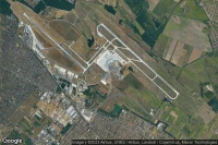
Bâle Mulhouse Fribourg (France)
EuroAirport Basel-Mulhouse-Freiburg airport aviation weather and facilities (LFSB BSL )
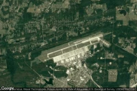
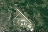
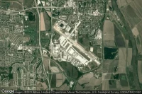
Dayton (United State)
Wright-Patterson Air Force Base airport aviation weather and facilities (KFFO FFO )


Beirut (Lebanon)
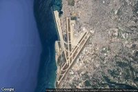
Beirut Rafic Hariri International airport aviation weather and facilities (OLBA BEY )
Knob Noster (United State)
Whiteman Air Force Base airport aviation weather and facilities (KSZL SZL )
Grand Forks (United State)
Grand Forks Air Force Base airport aviation weather and facilities (KRDR RDR )

Beaufort (United State)
Beaufort MCAS - Merritt Field airport aviation weather and facilities (KNBC )
Luanda (Angola)
Quatro de Fevereiro International airport aviation weather and facilities (FNLU LAD )
Budapest (Hungary)
Budapest Liszt Ferenc International airport aviation weather and facilities (LHBP BUD )

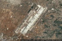
São Paulo (Brazil)
Guarulhos - Governador André Franco Montoro International airport aviation weather and facilities (SBGR GRU )

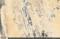
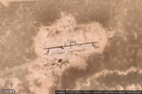
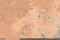
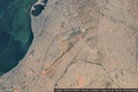
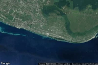
Diego Garcia (British Indian Ocean Territory)

Diego Garcia Naval Support Facility airport aviation weather and facilities (FJDG NKW )
Warner Robins (United State)
Robins Air Force Base airport aviation weather and facilities (KWRB WRB )
St Augustine (United State)

Northeast Florida Regional airport aviation weather and facilities (KSGJ UST )
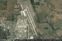
Fort Myers (United State)

Southwest Florida International airport aviation weather and facilities (KRSW RSW )
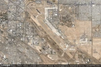
Palmdale (United State)

Palmdale Regional/USAF Plant 42 airport aviation weather and facilities (KPMD PMD )
San Diego (United State)
Miramar Marine Corps Air Station - Mitscher Field airport aviation weather and facilities (KNKX NKX )
Jacksonville (United State)
Little Rock Air Force Base airport aviation weather and facilities (KLRF LRF LRF)
Fort Worth (United State)

NAS Fort Worth JRB/Carswell Field airport aviation weather and facilities (KNFW FWH )
Fort Wayne (United State)

Fort Wayne International airport aviation weather and facilities (KFWA FWA )
Fort Huachuca Sierra Vista (United State)
Sierra Vista Municipal Libby Army Air Field airport aviation weather and facilities (KFHU FHU )
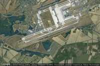
Atlanta (United State)

Hartsfield Jackson Atlanta International airport aviation weather and facilities (KATL ATL )
San Francisco (United State)
San Francisco International airport aviation weather and facilities (KSFO SFO SFO)

Patuxent River (United State)

Patuxent River Naval Air Station (Trapnell Field) airport aviation weather and facilities (KNHK NHK )
Fort Campbell Hopkinsville (United State)

Campbell AAF airport aviation weather and facilities (KHOP HOP )
Goldsboro (United State)
Seymour Johnson Air Force Base airport aviation weather and facilities (KGSB GSB )
Bossier City (United State)
Barksdale Air Force Base airport aviation weather and facilities (KBAD BAD )

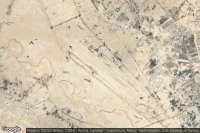
Rio Gallegos (Argentina)

Rio Gallegos Piloto Civil Norberto Fernández International airport aviation weather and facilities (SAWG RGL )
Springfield Chicopee (United State)
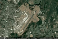
Westover ARB/Metropolitan airport aviation weather and facilities (KCEF CEF )
Data sources
- Infos générales : AVWX, France FFPLUM
- METAR : AVWX
- TAF : AVWX
- Météo générale : Openweathermap et AVWX
- NOTAM : FAA
- VAC : France DGAC/SIA, Espagne ENAIRE, Belgique SKEYES
- Aerial maps : Google Maps, Microsoft Bing ou OpenStreetMap