Airport information, from map to hotels via aeronautical information. And the aeronautical weather for the pilots with current weather and short-term forecasts with METAR (METeorological Aerodrome Report, observation message of meteorological conditions for aviation) and TAF (Terminal Aerodrome Forecast: short-term forecast message of meteorological conditions for aviation ). And other resources such as VAC (Visual Approach Chart) to prepare flights.


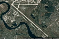
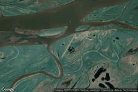
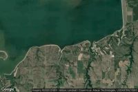
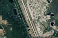
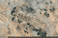
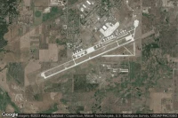
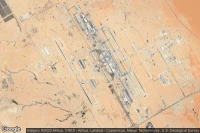
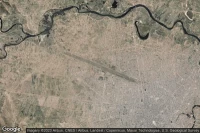
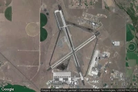
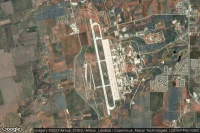
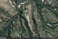
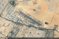
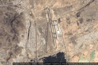
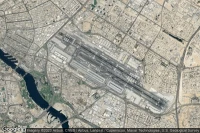
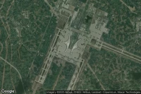
Ulyanovsk (Russian Federation)
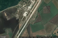
Ulyanovsk East airport aviation weather and facilities (UWLW ULY )
METAR TAF
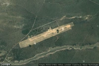
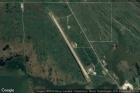
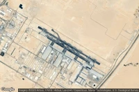
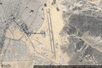
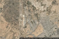
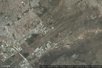
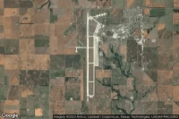
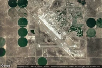
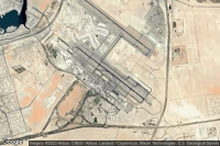
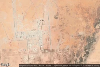
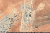
Upington (South Africa)
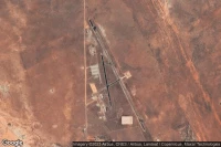
Upington International airport aviation weather and facilities (FAUP UTN )
METAR TAF
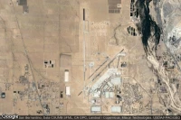
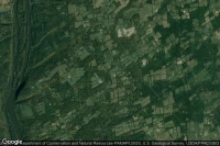
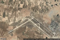
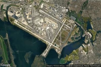
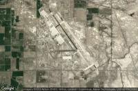
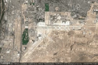
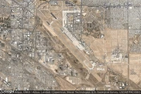
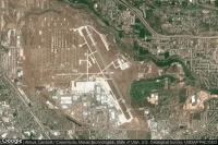
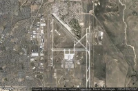
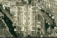
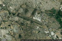
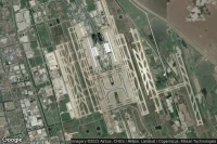
Denver (United State)
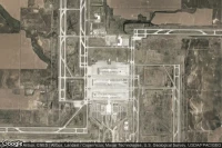
Denver International airport aviation weather and facilities (KDEN DEN DEN)
METAR TAF

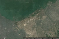
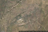
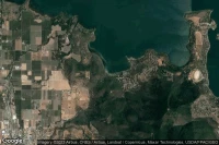
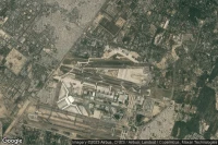
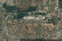
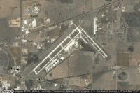
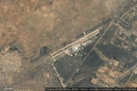
Harare (Zimbabwe)

Robert Gabriel Mugabe International airport aviation weather and facilities (FVRG HRE )
METAR TAF
Kinshasa (Democratic Republic of Congo)
Ndjili International airport aviation weather and facilities (FZAA FIH )
METAR TAF
Mafeking (South Africa)

Mmabatho International airport aviation weather and facilities (FAMM MBD )
METAR TAF
Moscow (Russian Federation)
Zhukovsky International airport aviation weather and facilities (UUBW ZIA )
METAR TAF
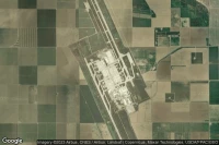
Victorville (United State)
Southern California Logistics airport aviation weather and facilities (KVCV VCV )
METAR
Windhoek (Namibia)
Hosea Kutako International airport aviation weather and facilities (FYWH WDH )
METAR TAF

Lompoc (United State)

Vandenberg Air Force Base airport aviation weather and facilities (KVBG VBG )
METAR TAF
Titusville (United State)
Nasa Shuttle Landing Facility airport aviation weather and facilities (KTTS )
METAR


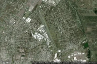
Kunming (China)

Kunming Changshui International airport aviation weather and facilities (ZPPP KMG )
METAR TAF

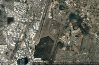
New Delhi (India)
Indira Gandhi International airport aviation weather and facilities (VIDP DEL )
METAR TAF
Fairbanks (United State)
Eielson Air Force Base airport aviation weather and facilities (PAEI EIL )
METAR TAF
Las Vegas (United State)

McCarran International airport aviation weather and facilities (KLAS LAS )
METAR TAF
New York (United State)
John F Kennedy International airport aviation weather and facilities (KJFK JFK JFK)
METAR TAF
Johannesburg (South Africa)
O R Tambo International airport aviation weather and facilities (FAOR JNB )
METAR TAF
Fallon (United State)
Fallon Naval Air Station airport aviation weather and facilities (KNFL NFL )
METAR TAF
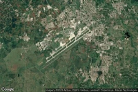
Mandalay (Myanmar)

Mandalay International airport aviation weather and facilities (VYMD MDL )
METAR TAF


Hyderabad (India)
Rajiv Gandhi International airport aviation weather and facilities (VOHS HYD )
METAR TAF

Spokane (United State)
Fairchild Air Force Base airport aviation weather and facilities (KSKA SKA )
METAR TAF
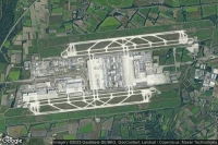
Paris (France)
Paris Charles de Gaulle International airport aviation weather and facilities (LFPG CDG )
METAR TAF
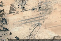
Riyadh (Saudi Arabia)
King Khaled International airport aviation weather and facilities (OERK RUH )
METAR TAF
Albuquerque (United State)
Albuquerque International Sunport airport aviation weather and facilities (KABQ ABQ )
METAR TAF
Bishkek (Kyrgyzstan)

Manas international airport airport aviation weather and facilities (UCFM BSZ )
METAR TAF

Toluca (Mexico)
Licenciado Adolfo Lopez Mateos International airport aviation weather and facilities (MMTO TLC )
METAR TAF
Juliaca (Peru)
Inca Manco Capac International airport aviation weather and facilities (SPJL JUL )
METAR TAF
Tucson (United State)
Davis Monthan Air Force Base airport aviation weather and facilities (KDMA DMA )
METAR TAF
Kuala Lumpur (Malaysia)
Kuala Lumpur International airport aviation weather and facilities (WMKK KUL )
METAR TAF
Nairobi (Kenya)
Jomo Kenyatta International airport aviation weather and facilities (HKJK NBO )
METAR TAF
Ogden (United State)
Hill Air Force Base airport aviation weather and facilities (KHIF HIF )
METAR TAF
Moses Lake (United State)
Grant County International airport aviation weather and facilities (KMWH MWH )
METAR TAF
Lemoore (United State)
Lemoore Naval Air Station (Reeves Field) airport aviation weather and facilities (KNLC NLC )
METAR TAF
Mountain Home (United State)
Mountain Home Air Force Base airport aviation weather and facilities (KMUO MUO )
METAR TAF
Abilene (United State)
Dyess Air Force Base airport aviation weather and facilities (KDYS DYS )
METAR TAF
Colorado Springs (United State)
City of Colorado Springs Municipal airport aviation weather and facilities (KCOS COS )
METAR TAF
Amarillo (United State)
Rick Husband Amarillo International airport aviation weather and facilities (KAMA AMA )
METAR TAF


Quito (Ecuador)
Mariscal Sucre International airport aviation weather and facilities (SEQM UIO )
METAR TAF
Dallas Fort Worth (United State)
Dallas Fort Worth International airport aviation weather and facilities (KDFW DFW )
METAR TAF
Tel Aviv (Israel)
Ben Gurion International airport aviation weather and facilities (LLBG TLV )
METAR TAF
Yuma (United State)

Yuma MCAS/Yuma International airport aviation weather and facilities (KNYL YUM )
METAR TAF
Batam Island (Indonesia)
Hang Nadim International airport aviation weather and facilities (WIDD BTH )
METAR TAF
Minot (United State)

Minot Air Force Base airport aviation weather and facilities (KMIB MIB )
METAR TAF
Medina (Saudi Arabia)
Prince Mohammad Bin Abdulaziz airport aviation weather and facilities (OEMA MED )
METAR TAF
Guadalajara (Mexico)
Don Miguel Hidalgo Y Costilla International airport aviation weather and facilities (MMGL GDL )
METAR TAF
Santiago (Cuba)

Antonio Maceo International airport aviation weather and facilities (MUCU SCU )
METAR TAF
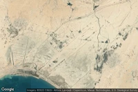
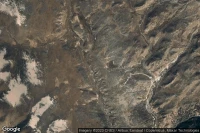
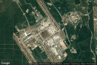
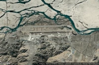
Dugway Proving Ground (United State)
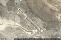
Michael AAF (Dugway Proving Ground) airport aviation weather and facilities (KDPG DPG )
METAR
Al Ain (United Arab Emirates)
Al Ain International airport aviation weather and facilities (OMAL AAN )
METAR TAF

Baku (Azerbaijan)

Heydar Aliyev International airport aviation weather and facilities (UBBB GYD )
METAR TAF


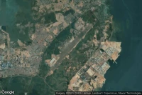
Rio De Janeiro (Brazil)
Rio Galeão – Tom Jobim International airport aviation weather and facilities (SBGL GIG )
METAR TAF
Gaborone (Botswana)
Sir Seretse Khama International airport aviation weather and facilities (FBSK GBE )
METAR TAF

Jianyang, Chengdu (China)
Chengdu Tianfu International airport aviation weather and facilities (ZUTF TFU )
METAR TAF
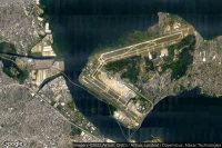
Shanghai (China)
Shanghai Pudong International airport aviation weather and facilities (ZSPD PVG )
METAR TAF

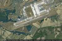
Munich (Germany)
Munich Franz-Josef-Strauß airport aviation weather and facilities (EDDM MUC )
METAR TAF
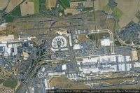
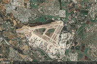
Frankfurt am Main (Germany)
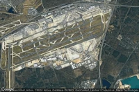
Frankfurt am Main airport aviation weather and facilities (EDDF FRA )
METAR TAF
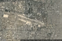
Hurghada (Egypt)
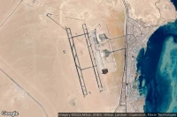
Hurghada International airport aviation weather and facilities (HEGN HRG )
METAR TAF
Data sources
- Infos générales : AVWX, France FFPLUM
- METAR : AVWX et NOAA
- TAF : AVWX et NOAA
- Météo générale : Openweathermap et AVWX
- NOTAM : FAA
- VAC : France DGAC/SIA, Espagne ENAIRE, Belgique SKEYES
- Aerial maps : Google Maps, Microsoft Bing ou OpenStreetMap